
// Service area · High Desert
Photogrammetric Mapping in the High Desert
Victor Valley and Antelope Valley — large parcels, open terrain.
Mapping in the High Desert
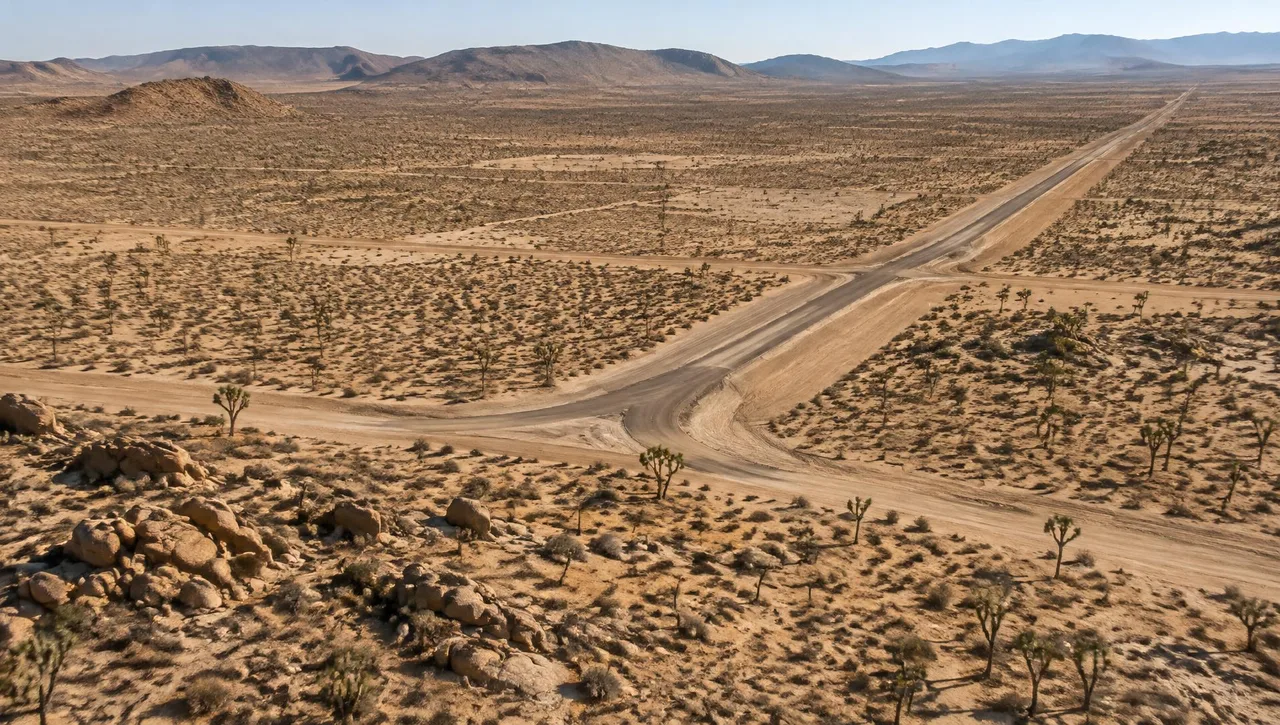
The High Desert covers the Victor Valley in San Bernardino County and the Antelope Valley in northern Los Angeles County — a broad expanse of open land north of the San Gabriel and San Bernardino Mountains. Unlike the built-out coastal basins, development here typically happens on large-acreage parcels: tens or hundreds of acres of raw desert rather than tight infill lots. That scale changes how teams plan mapping. Aerial photogrammetry tied to control supplied by the client’s surveyor provides continuous coverage without requiring detailed ground shots across every visible surface. Large, open sites are well suited to aerial photography, stereo compilation and orthophotos, while field observations remain necessary for obscured features.
Desert terrain brings its own considerations. Much of the region drains through broad, shallow washes and alluvial fans rather than defined channels, so drainage and flood considerations depend on accurate elevation data across the whole parcel — not just along a centerline. Surface visibility and image interpretation also matter: brush, shadows and localized erosion can conceal features or complicate terrain compilation. Mapping limits should include the drainage context needed by the engineer. Field control, project coordinates and any supplemental observations should be coordinated with the client’s surveyor before collection.
Growth in the region is driven by residential tracts in the Victor Valley and Antelope Valley, industrial and logistics development along the I-15 and SR-138 corridors, and utility-scale solar and energy projects that need mapping across very large sites. Each of these typically starts with the same foundation: accurate existing-conditions topography, coordinated terrain models and imagery for planning and design. Specify map scale, contour interval and intended use up front. Orthophotos help teams interpret existing roads, grading and site changes; a DTM supports the elevation analysis. Historical aerial imagery can provide additional context about earlier grading and drainage patterns.
Cities served in the Victor Valley & Antelope Valley
- Victorville
- Hesperia
- Apple Valley
- Adelanto
- Barstow
- Lancaster
- Palmdale
Relevant mapping services
Photogrammetric Mapping
Continuous mapping of large open parcels.
Learn moreDTM & DEM
Elevation models for desert washes and alluvial fans.
Learn moreAerial Photography (B&W, Color & Infrared)
Broad coverage for residential, industrial and solar-site planning.
Learn moreDigital Orthophotography
Visible site context coordinated with terrain data.
Learn more
High Desert FAQs
Is aerial mapping a good fit for High Desert parcels?
Large open sites are well suited to aerial photogrammetry tied to control supplied by the client’s surveyor. Terrain visibility and the required accuracy determine the mapping approach.
Can historical imagery help assess earlier site conditions?
Historical aerial photography may reveal earlier grading, road alignments and drainage patterns. Arrowhead’s archive spans 1965 to present; specific site and date coverage must be confirmed.
Do you cover both the Victor Valley and Antelope Valley?
Yes — the High Desert service area includes both valleys, from Victorville and Apple Valley to Lancaster and Palmdale.
How can mapping support drainage analysis?
A DTM and contours provide elevation information across washes and alluvial fans for the engineer’s analysis. Set mapping limits to include the needed drainage context; field control is supplied by the client’s surveyor.
What mapping should solar or industrial teams specify?
Define site limits, map scale, contours, accuracy, coordinate system and imagery requirements. Large-area topography and orthophotos provide base information for planning and design.
// Request a quote
Mapping work in the High Desert
Send us your plans and schedule. We'll respond with a clear scope, fee and timeline.
Questions or quotes: Jeff Dillon, jeff@arrowheadmapping.com · (909) 889-2420