
// Service
Photogrammetric Topographic Mapping for Design
Digital topographic and planimetric mapping led by Steve Dillon, ASPRS Certified Photogrammetrist #790.
Mapping led by Steve Dillon, ASPRS Certified Photogrammetrist #790
What is it?
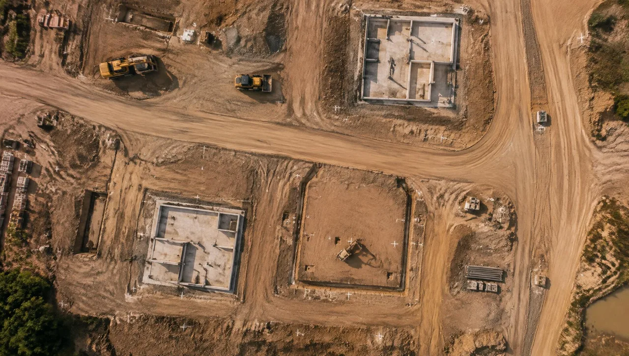
Photogrammetry uses overlapping aerial photography to compile digital topographic and planimetric mapping. Arrowhead Mapping delivers terrain models, contours, mapped visible features and orthophotos for civil design and agency projects. Steve Dillon, ASPRS Certified Photogrammetrist since 1989, Certificate #790, leads this work. Field ground control is supplied by the client’s surveyor; Arrowhead performs the aerial photography and photogrammetric mapping.
Typical uses
- Grading, drainage and hydrology design
- Housing developments and street improvements
- Schools, colleges and reclamation projects
- Topography and aerial mapping for ALTA/NSPS surveys
Deliverables
Delivered in your coordinate system and CAD standards, ready to drop into design.
| Ref | Deliverable | Specification |
|---|---|---|
| D-01 | Topographic mapping | Contours generated from the DTM at the project-specified interval |
| D-02 | Terrain surfaces | Digital terrain models (DTM / DEM) and TIN surfaces |
| D-03 | Orthophotos | Orthorectified, georeferenced imagery at project resolution |
| D-04 | Planimetric mapping | Edge of pavement, curbs, structures and utilities visible from the air |
| D-05 | File formats | CAD and digital imagery formats agreed with the receiving team |
Accuracy & standards
- Standard
Products meet or exceed National Map Accuracy Standards.
- Reporting
Horizontal and vertical accuracy specified and reported per project.
- Verification
Field ground control supplied by the client’s surveyor; independent QC review of every stereo model.
- Datums
California Coordinate System (CCS83 / State Plane) zones and NAVD88 vertical datum, or project-specific / local datums on request.
- Public agencies
Mapping can follow agency or Caltrans mapping requirements where specified.
- Certification
Steve Dillon, ASPRS Certified Photogrammetrist since 1989, Certificate #790.
Ground control
- GC-01 · Targets
Control points are determined and shown on the supplied map before photography.
- GC-02 · Survey
Field ground control is supplied by the client’s surveyor, tied to the required project datum.
- GC-03 · QA/QC
Independent QC review of every stereo model checks completeness and accuracy; final CAD receives another stereo review.
Aerial vs. ground survey
Aerial mapping complements field measurements supplied by your surveyor. Obscured features and detailed field observations remain with that team.
| Factor | Favors aerial | Favors ground |
|---|---|---|
| Site size | Large sites, long corridors | Small or compact sites |
| Access | Hard-to-access, unsafe or active sites | Sites with easy, safe access |
| Detail | Surfaces, planimetrics, imagery over wide areas | Inverts, under-canopy, fine hardscape detail |
| Vegetation | Open or lightly vegetated terrain | Dense canopy or brush |
| Best result | Often combined with ground survey | Often combined with aerial mapping |
Mapping for ALTA/NSPS surveys
Arrowhead supplies topography and aerial mapping to the surveyor of record for ALTA/NSPS surveys. Table A Item 5 concerns vertical relief, including the source of information, contour interval, datum and originating benchmark. Define those requirements with the surveyor of record; Arrowhead’s contribution is photogrammetric mapping, not the field land-title survey.
Typical process
- 01
Plan to the specification
Flight plans are designed for the accuracy required by the final map scale and contour specifications. Ground control is supplied by the client’s surveyor; control points are determined and shown on the supplied map.
- 02
Acquire and check photography
Wild RC30 photography uses image motion compensation. Flights take place on clear days with at least 5 miles visibility per FAA flight service, between 10:30 a.m. and 2:30 p.m. Photography is checked for overlap, sidelap, tip and tilt.
- 03
Process and scan film
Film is processed in a Versamat processor and scanned on a Wehrli precision photogrammetric scanner.
- 04
Compile and review each stereo model
Topographic mapping is compiled on Leica/KLT softcopy stereo instruments. Independent QC review of every stereo model checks completeness and accuracy.
- 05
Consolidate and review CAD
A CAD editor consolidates models into a master DTM file and a separate planimetric file. Contours are generated from the DTM, and final CAD is reviewed again on the stereo instrument.
- 06
Generate and verify orthophotos
Black-and-white and color orthophotos are generated from the final DTM, typically at 0.25 ft pixel size, varying with project size. The planimetric file is overlaid on the orthophoto to check horizontal position. Products meet or exceed National Map Accuracy Standards; accuracy is specified per project.
Related experience
- Eastern Transportation Corridor (Route 241)
- San Joaquin Hills Transportation Corridor (Route 73)
- L.A. Metro Rail
- Saddleback College
Frequently asked questions
Who supplies field ground control?
The client’s surveyor supplies field ground control. Control points are determined and shown on the supplied map; Arrowhead uses this control for aerial photography and photogrammetric mapping.
How is mapping accuracy checked?
Independent QC review of every stereo model checks completeness and accuracy. Final CAD is reviewed again on the stereo instrument. Products meet or exceed National Map Accuracy Standards; accuracy is specified per project.
Can you provide mapping for ALTA/NSPS surveys?
Yes. Topography and aerial mapping can be supplied to the surveyor of record for ALTA/NSPS surveys, including vertical-relief information for Table A Item 5. The surveyor of record is responsible for the ALTA/NSPS survey.
Does aerial mapping replace all field work?
No. Features obscured from the camera, underground utilities and detailed field measurements require the client’s surveyor or other appropriate specialists. Aerial mapping complements their field work.
// Request a quote
Have a project on the board?
Send us your plans and schedule. We'll respond with a clear scope, fee and timeline.
Questions or quotes: Jeff Dillon, jeff@arrowheadmapping.com · (909) 889-2420